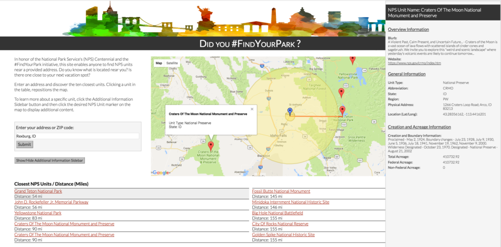
As I’ve been on this journey, I find myself repeating the same task over and over… I’m headed somewhere, I filter a list or open a book to find out what units are in that state and then I map them out and determine if any are close by. After what felt like the thousandth time, I created a tool that would simplify this process. In honor of the National Park Service’s #FindYourPark social media tag and since it was at the heart of this tool’s purpose, I decided to incorporate the tag into the name.

To interact with the site, please go here: https://www.tangible-america.com/NPS-FindYourPark.html
This site allows a reader to enter a location and it will highlight the ten closest NPS units. Additionally, it provides range circles to highlight what else might be within 5 or 50 miles. I chose these specific distances to give a reader the sense of what is “next door” and what is within an hour of the entered location. The last component of the site is a basic information source and pointer to NPS resources for more details. With or without entering an address, a reader is able to open an information panel and select any unit to learn more. The information panel includes, but not limited to: a brief blurb about the unit, the NPS unit’s website, the physical address of unit, and creation information. All information came directly from NPS sources.
In future phases of this tool, I’d like to add NPS affiliated areas as well as nearby transportation options (e.g., airports and train stations) to help with trip planning.
Now the question is, Did you #FindYourPark?


